Međugorje · Bosna i Hercegovina
Map of Medjugorje
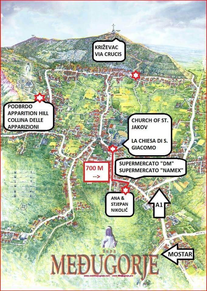
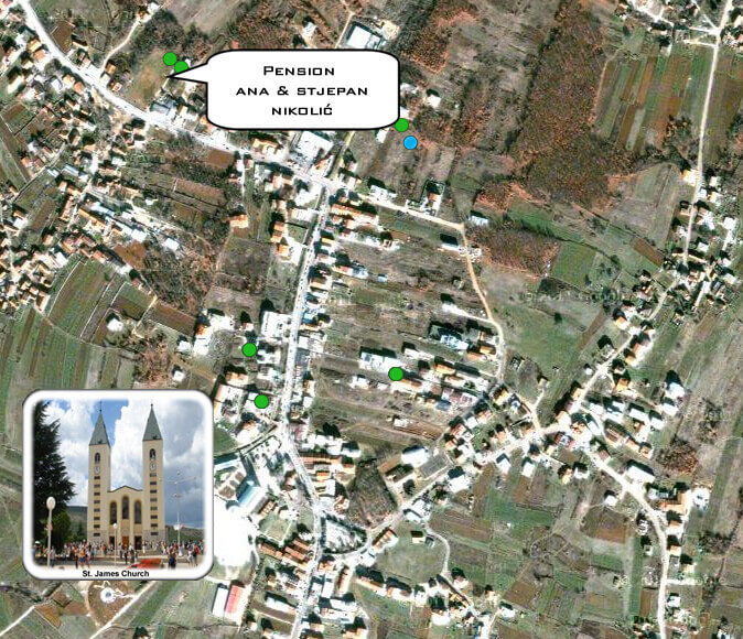
Two maps to help you find your way around the shrine — and to our guesthouse. Save them to your phone, or print them before you travel.
Where is Medjugorje?
Medjugorje is in Bosnia and Herzegovina — in Herzegovina, the southern part of the country, in the municipality of Čitluk. Its coordinates are 43.196632, 17.676224.
It is often looked up together with Croatia, and it is easy to see why: the Croatian border is close, and most pilgrims fly into Split or Dubrovnik. But Medjugorje itself is in Bosnia and Herzegovina — you cross a border on the way here, and the local currency is the convertible mark (BAM), though euros are widely accepted.
From our guesthouse, Mostar is about 30 km away — roughly 35 minutes by car. Split is about 155 km (1 h 50 min), Dubrovnik about 145 km (2 h 25 min) and Sarajevo about 145 km (2 h 35 min). The drives to Split and Dubrovnik cross the border, so allow extra time in high season.
Tap a map to open it full size.
Pilgrim map of Medjugorje
Satellite map — how to find us
Questions before you travel
Is Medjugorje in Croatia?
No. Medjugorje is in Bosnia and Herzegovina, in Herzegovina, close to the Croatian border. Most pilgrims fly into Split or Dubrovnik in Croatia and continue by road, crossing the border on the way.
Do I need a passport to travel to Medjugorje?
To enter Bosnia and Herzegovina you need a passport or another internationally recognised identification document — for children too.